
For those who enjoyed the From the Serial Set series, welcome back! Today’s post is a crossover between two of Visual Information Specialist Bailey’s favorite things – exploring nature across the country and understanding how the law interacts with it.
The Matanuska Glacier, located in the Matanuska Valley of Alaska, is a 27-mile-long formation sprawling from the foot of the Chugach Mountains. Glaciers, which originally form on land and slowly succumb to gravity over time, are types of rocks that form in areas with both regular snowfall accumulation and temperatures consistently around freezing. Among the many glaciers in Alaska, the Matanuska Glacier is visible from the roadway.

Beginning in 1879, the U.S. Geological Survey was established to conduct surveys of public lands and analyze the geologic structure, including minerals and other resources (20 Stat. 377).
You can find historic bulletins of the U.S. Geological Survey in the United States Congressional Serial Set. The Matanuska Valley is mentioned as early as 1899, when the climate, natural resources, and topography were mapped the year prior. Submitted as a part of the Director’s annual report to Congress in 1899, A Reconnaissance from Resurrection Bay to the Tanana River, Alaska maps a route that passes the glacier.
A 1907 report surveying the Matanuska and Talkeetna Regions of Alaska mentions multiple glaciers, including Matanuska, from a 1906 survey expedition.
“[T]he largest glacier of the valley is the Matanuska Glacier with a frontage of 3 at the heads of the canyons which furrow the southern valley wall, but largest glacier of the valley is the Matanuska Glacier with a frontage of miles along the river. The course of this stream can be traced from the top of Glacier Point for 25 or 30 miles to the southeast. Its source here is probably the névé which follows the crest of the Chugach Range to the east, and gives rise to the various glaciers which flow down to Prince William Sound on the south and to the Tazlina and Klutina rivers on the north.” U.S. Geological Survey Bulletin No. 327, p. 34.
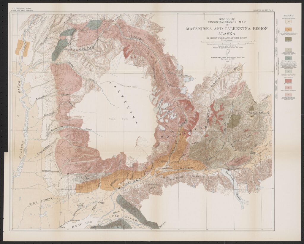
“The exact mode of origin of Matanuska Valley can not [sic] yet be regarded as established,” wrote Sidney Paige and Adolph Knopf, the surveying geologists. In a 1964 bulletin, Arthur Grantz determined that the glacier itself was primarily responsible for carving out the valley.
“Evidence is plentiful that the glaciers are rapidly retreating,” wrote Paige and Knopf in 1907, observing the fragmenting of smaller glaciers from the main formation. The National Park Service continues to observe the same today. The U.S. Geological Survey continues to monitor the changing landscape of glaciers in select parts of the country, as well as several more in Alaska. As recently as 2008, the Matanuska Glacier was an important part of the Survey’s hydrology studies.
Below are other bulletins and resources I encountered during my research process. While not explicitly mentioning the Matanuska Glacier, they give terrific insight into other parts of the Alaskan terrain.
- The Broad Pass Region, Alaska. U.S. Geological Survey Bulletin 608 (reprinted in Serial Set No. 6820 (H. Doc. 63-1690), 1915)
- Coastal Glaciers of Prince William Sound and Kenai Peninsula, Alaska. U.S. Geological Survey Bulletin 526 (reprinted in Serial Set No. 6412 (H. Doc. 62-1239), 1913)
- Geographic Dictionary of Alaska. U.S. Geological Survey Bulletin No. 299 (reprinted in Serial Set No. 5018 (H. Doc. 59-938), 1906)
- Glacier Photograph Collection, National Snow and Ice Data Center, University of Colorado at Boulder
- Geography and Map Division: Maps of Alaska
It isn ot always expected that legislative history and the natural world overlap, but the Serial Set remains one of the many collections in the Law Library that can help us understand a new perspective of our world. We hope that this has sparked your curiosity about the fascinating landforms known as glaciers and the other wonders the Serial Set holds.
Subscribe to In Custodia Legis – it’s free! – to receive interesting posts drawn from the Law Library of Congress’s vast collections and our staff’s expertise in U.S., foreign, and international law.